

The Sow of Atholl [Meall an Dobharchain]
Good walks are even better shared.
NN6274 : On The Sow of Atholl - view towards Sgairneach Mhor
Colin Park Photo source
Overview
The Sow of Atholl [Meall an Dobharchain]
Introduction
Nestled in the stunning Scottish Highlands, The Sow of Atholl stands tall as a Munro, inviting hikers and enthusiasts to embrace its unpredictable weather and scenic views. At an elevation of 763 meters, it looms over the landscape with a storied history and geological beauty.
Geology
The Sow of Atholl is primarily composed of schist and granite, offering hikers a fascinating geological tapestry to ponder as they navigate its rocky pathways. Glacial striations seen in various sections whisper tales of ancient ice ages that sculpted this majestic hillside. Be sure to bring your geological magnifying glass, or just admire the rocks from a distance!
Routes
Several routes wend their way up the sow, including the popular Culra Path, which is both a scenic and enjoyable trek. For more adventurous souls, the South East Ridge provides a challenging scramble adorned with thrilling rocky outcrops. No matter which route you choose, ensure you're equipped with hearty snacks and perhaps a hilarious podcast for company!
Summit Features
Upon reaching the summit, you're greeted with a robust cairn and panoramic vistas that will undoubtedly make your friends jealous. It's the perfect spot to reflect on the trek and appreciate the natural beauty surrounding you.
Terrain
Expect a medley of grassy slopes, rocky outcrops, and those sneaky boggy patches that can turn your boots into sponges. The craggy peaks and lush valleys offer a delightful contrast, providing a variety of walking experiences.
Views
The summit grants an eyeful of the surrounding landscape, showcasing impressive sights like Ben Alder and the serene Loch Ericht. For the best views, aim for spring or early autumn when the skies are clear and the heather blooms vibrantly.
Hazards
This area is notorious for its fickle weather. Be prepared for sudden gusts of wind and unexpected rain. Additionally, watch your step on rocky slopes and be mindful of bogs along your route to avoid an unplanned swim!
Nearby Summits
Exploring the vicinity, hikers can also easily take in the towering Ben Alder and Creag Pitridh, both of which offer further delightful challenges and stunning views.
Access
Getting there is a cinch! The nearest parking is in Dalwhinnie, around 11 km from the starting points. A reliable bus service connects Dalwhinnie to other urban areas, making it accessible for thrifty adventurers.
Facilities
Though remote, Dalwhinnie does provide essentials like a local shop and café to stock up on energy-boosting snacks and comforts before (or after) your hike.
History
The mountain's name, 'Meall an Dobharchain', reflects the small streams weaving through the landscape—perfect for sipping on fresh Highland water at the summit! The region has been a key droving route historically, filled with stories and cultural significance.
Conclusion
Whether you're a seasoned Munro-bagger or a curious newcomer, The Sow of Atholl promises a memorable adventure steeped in nature, discovery, and a dash of Scottish magic. Don't forget your camera; the views are just asking to be shared!
Happy hiking!
Explore routes near The Sow of Atholl [Meall an Dobharchain]
Walks starting near this hill. Open a route to check its map, distance and full itinerary.
Kenmore: Drummond Hill Black Rock Trail above Loch Tay
View route
Aberfeldy: Glassie Woodland and River Tay Circular
View route
Killin: Falls of Dochart, Finlarig and Moirlanich Longhouse
View route
Fort Augustus to Kytra Lock: Caledonian Canal Towpath
View route
Route planning notes
These notes describe possible approaches. Check a route's map and access information when planning your walk.
The Culra Path
A popular path starting from the north, winding through scenic landscapes with moderate inclines leading towards the summit.
The South East Ridge
A more challenging ascent that offers a direct route with rocky scrambles, ideal for those looking for a bit of extra excitement.
Make a day of it, together
Find someone to share the walk with, or organise a day out along a route you like.
Photo Gallery
View all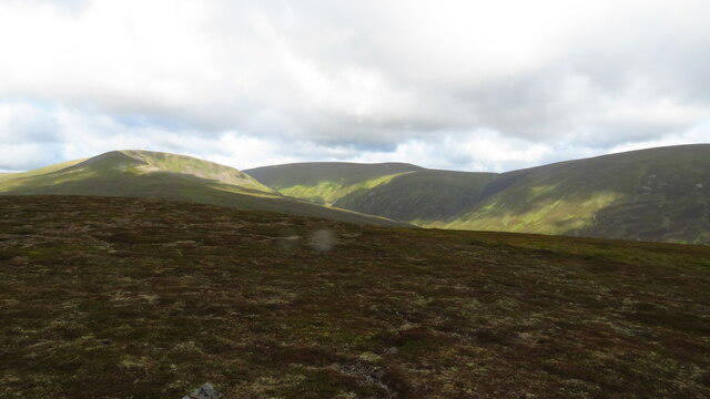 Photo could not load
NN6274 : On The Sow of Atholl - view towards Sgairneach Mhor
Colin Park
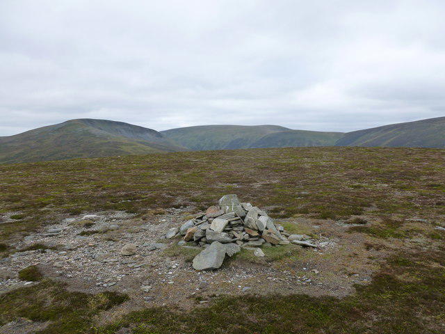 Photo could not load
NN6274 : Summit Cairn, Sow of Atholl (Meall an Dobharchain)
Alan O'Dowd
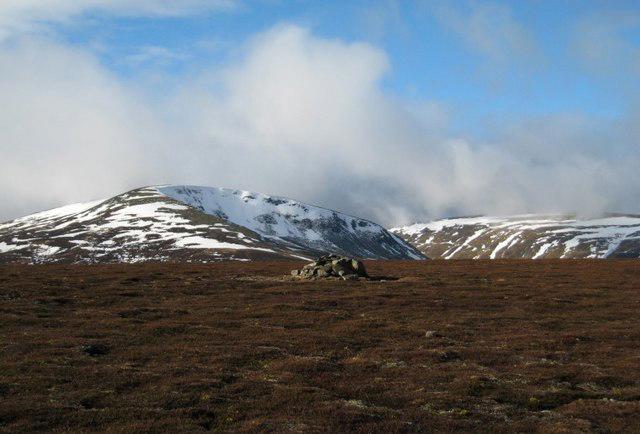 Photo could not load
NN6274 : Sow of Atholl
Hill Walker
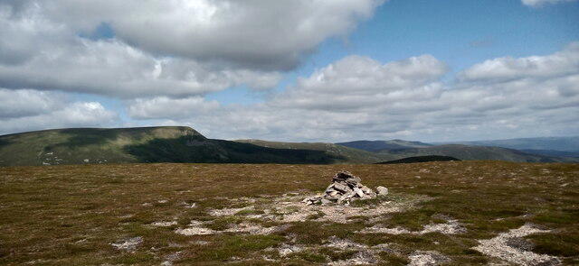 Photo could not load
NN6274 : The Sow of Atholl, summit
Iain Russell
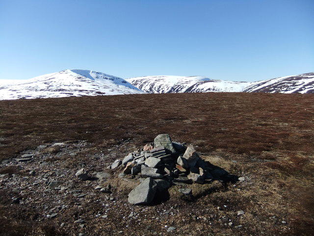 Photo could not load
NN6274 : Summit, Sow of Atholl
David Brown
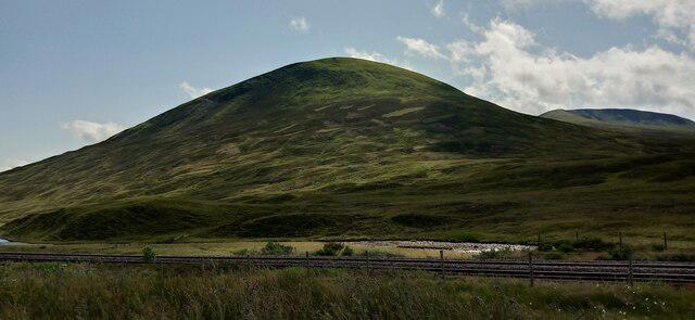 Photo could not load
NN6274 : The Sow of Atholl
Iain Russell
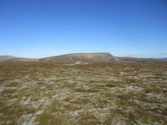 Photo could not load
NN6274 : Sow of Atholl Summit
Scott Cormie
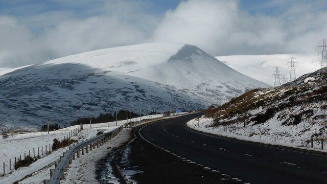 Photo could not load
NN6274 : A snowy Sow of Atholl
Sandy Gerrard
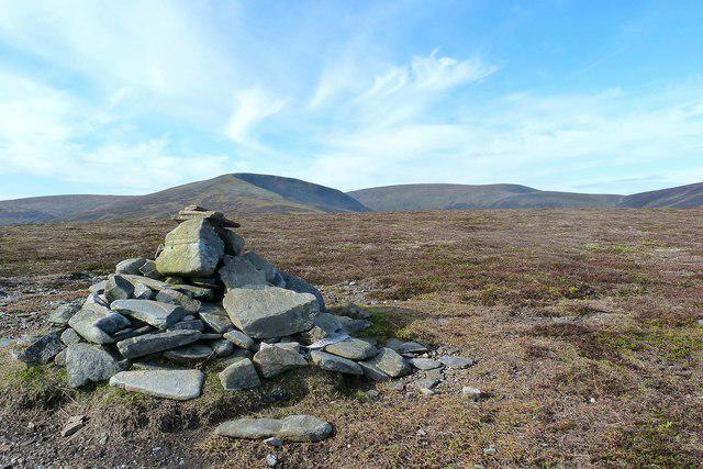 Photo could not load
NN6274 : The Sow of Atholl (summit cairn)
Raibeart MacAoidh
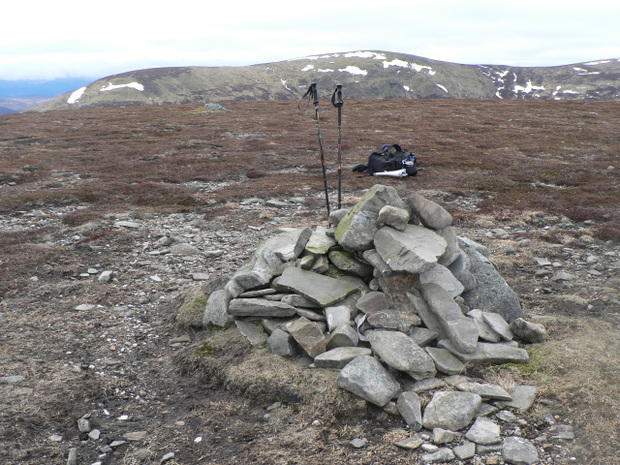 Photo could not load
NN6274 : The Sow of Atholl
Liz Gray
Hill facts and local notes
Classifications
Elevation
799m
2,621 ft
Prominence
161m
Coordinates
56.8381, -4.2552
NN625741
OS Map
42
Explorer: OL50 393
At the Summit
The summit features a distinctive cairn, providing both a picturesque viewpoint and a perfect spot for a well-earned cuppa.
Terrain & Geology
Dominated by schist and granite formations, providing a beautiful array of rock types and textures; some areas exhibit glacial striations hinting at the mountain's icy past.
Views & Scenery
Breathtaking views of the surrounding hills, including the majestic Ben Alder and the beautiful Loch Ericht.
History & Heritage
Name Origin
The name 'Meall an Dobharchain' translates to 'hill of the little black stream', reflecting the numerous waterways that traverse the area.
Historical Significance
Historically, this region was a route for drovers leading sheep from the east to the markets, steeped in local folklore and rugged tales of the highlands.
Getting There & Facilities
Parking
The nearest parking area is at Dalwhinnie, approximately 11 km away, with ample space for vehicles.
Public Transport
The area is accessible via public transport to Dalwhinnie, with occasional bus services connecting to nearby towns.
Nearby Facilities
While the immediate surroundings are quite remote, Dalwhinnie offers a local shop and a café for all your pre-hike snacks and last-minute preparations.
Safety Information
Known Hazards
- Potential for sudden weather changes; be prepared for rain and wind even when the forecast looks promising. Slippery rocks and boggy areas can also present challenges.
General Safety Tips
- Check weather conditions before setting out
- Carry appropriate clothing and equipment
- Let someone know your planned route
- Take a map, compass, and GPS device
- Carry emergency supplies: food, water, first aid kit, torch
Hills
Some common questions about the hills answered
Are there group walks up The Sow of Atholl [Meall an Dobharchain]?
Many walkers use Walkmates to join or organise walks with others. You can check for group walks around The Sow of Atholl [Meall an Dobharchain] through the maps
Are there other walkers around The Sow of Atholl [Meall an Dobharchain]?
Activity varies by location and time, but Walkmates lets you see whether others have shared walks or shown interest in this area. Find other people through the walking friends search walking friends for The Sow of Atholl [Meall an Dobharchain] search or of course create your own walk for The Sow of Atholl [Meall an Dobharchain]
Can I organise a walk to The Sow of Atholl [Meall an Dobharchain]?
Yes. If there aren’t any walks listed already, you can create a walk and make it available for others to join.
If you're signed up to Walkmates, you can create a walk to The Sow of Atholl [Meall an Dobharchain].
How do I find a walk up this hill?
There are often multiple ways to walk this hill, depending on experience and route preference. Walkmates helps you explore walks and routes that others have shared.
Can I suggest a new route up The Sow of Atholl [Meall an Dobharchain]?
Yes. You can suggest or create routes to share with others. Walkmates focuses on the social side of walking, so routes are used to help people organise walks and explore areas together, rather than as detailed navigation tools or route libraries.
Other uses really appreciate knowledgeable walkers sharing their routes. Share your favourite route to The Sow of Atholl [Meall an Dobharchain] here
The is an error or something incorrect about this hill. How do I let you know?
We always strive to keep the information on Walkmates as accurate as possible. If you find an error, please let us know through the contact form and we'll aim to correct it as quickly as possible
Community Discussion
Comments
Location
![The Sow of Atholl [Meall an Dobharchain] location map](https://cdn.walkmates.com/hill-maps/hill-sources/401/56.83810_-4.25518.png)
Grid reference: NN625741
View on OpenStreetMapOpens a map in a new tab, centred on the hill.
No comments yet. Be the first.